An open, seasonally wet patch beside a new road can look like unused land. During rain, it may become part of the neighborhood’s storage and drainage system. For birds, amphibians, and other wildlife, the same patch can connect feeding, shelter, and breeding habitat.
My Diabari work combines historical imagery, ecological records, and an environmental and social impact assessment (ESIA) approach. The useful question is what a proposed change would interrupt, and how that interruption could be avoided.
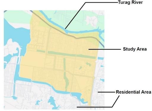
Read the connected landscape
A wetland’s function depends on more than its boundary. Look for the route by which water enters, the level at which it leaves, and the roads or crossings between patches. A small remaining channel can be important even when the larger water body is still visible on a map.
Use images from comparable seasons. A dry-season image and a monsoon image can make normal seasonal change look like permanent loss. Cloud cover, mixed pixels, aquatic vegetation, and bare soil also affect interpretation. Remote sensing helps locate questions for site verification.
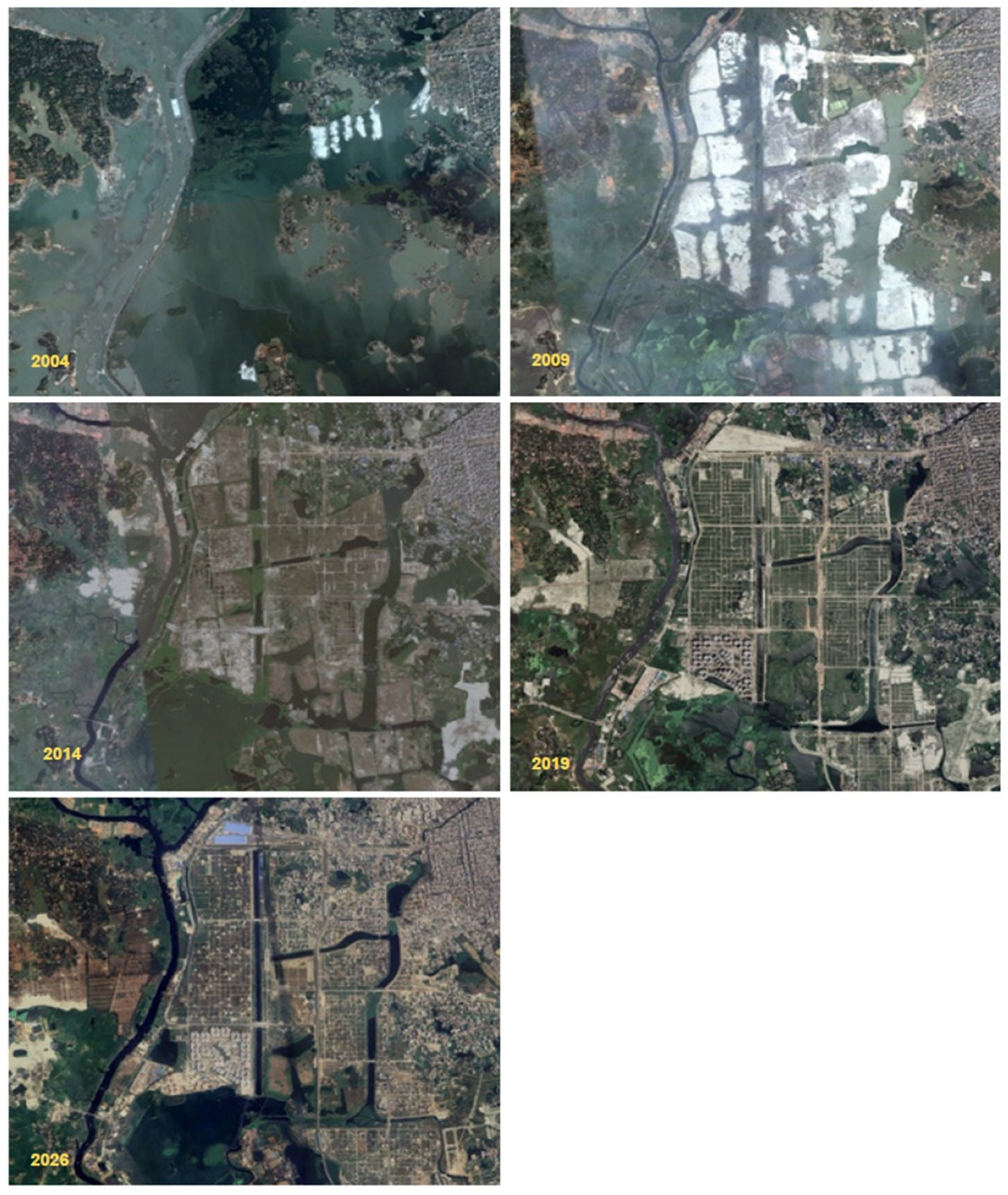
Turn a map into an impact question
| Pressure | Question for the site | Useful evidence |
|---|---|---|
| Land filling | Where will the displaced rainfall collect? | Ground levels, storage area, and connected outlets |
| A new road or crossing | Can water and wildlife still move between patches? | Culvert levels, flow paths, habitat connections |
| Waste dumping | Is access to collection and disposal reliable? | Repeated photographs and collection records |
| Recreation and vehicle movement | Which sensitive places need quieter access? | Habitat records and consultation with local users |
Apply the mitigation order
- Avoid damage by retaining the most important wetland patches and drainage connections in the layout.
- Minimize disturbance through controlled access, reliable waste collection, and a defined construction boundary.
- Restore damaged edges and flow paths with appropriate native vegetation and maintenance access.
- Address residual impacts through measures that can be monitored. A replacement green patch should be assessed against the functions that were lost.
This order belongs early in planning. Once the land is filled and the outfall is hidden beneath development, the options become narrower and more expensive.
Listen to the people who use the place
Residents can describe recurring waterlogging, access difficulties, dumping, and changes that a single image misses. Local ecological records can show which habitats deserve closer attention. The community records reviewed for this work provide context; direct discussion with affected residents and site surveys are still needed for a project decision.
Measure functions after the work
Keep a small monitoring record for waterlogging duration, visible channel connections, repeat dumping, vegetation survival, and seasonal habitat observations. Use the same locations and record the date and conditions. Species presence is useful ecological context, while water-quality claims need suitable sampling and laboratory evidence.
My practical view
I would begin by protecting the connected water route and the wetland patches around it. Then I would check whether the proposed access, waste collection, and restoration arrangements can be maintained. The desk review helps set those priorities; a detailed development decision needs site levels, seasonal observations, and consultation.
Sources and further reading
The figures and local ecological context come from the River & Delta Research Centre’s Biodiversity in Diabari: Periurban Nature in Dhaka (2026) and the community records cited in my source documents. For the wider drainage context, read the northern Dhaka urbanization and pluvial-flooding study.
Continue reading
Diabari Waterlogging and Solid Waste Management · Turag River Environmental Flow and Seasonal Change
Leave a Reply